Trail Maps and Routes
Explore the trails of OSCTRAIL MAPS
|
Omineca Ski Club offers various distance trail routes, a lit trail and dog friendly trails. Download the Avenza maps app to keep track of your location using our compatible maps! See Nordic Pulse for grooming updates.
|
Please review important safety information about OSC: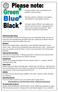 |
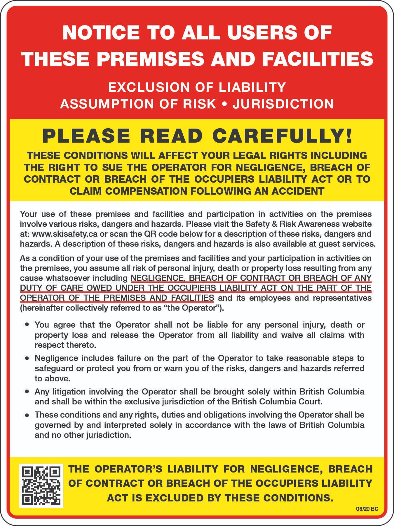
Exclusion of liability and assumption of risk: |
DOG TRAIL INFORMATION
Dog trails access is located off of Gilgan Road, just under 2 km away from Ski Club Road off of Highway 35.
Trails include Dog trail, Summit Loop, Taffy’s trot (newest!).
You can also take your dogs on Spud/Larch/Cedar area trails, but PLEASE be cautious as there is an active trapline in the area! Spud likely closed in 2024-2025 season due to logging.
**PLEASE KEEP YOUR DOGS CLOSE WHEN USING THE SPUD TRAIL SYSTEM AS THERE IS AN ACTIVE TRAPLINE IN THE AREA**
GROOMING PROTOCOLS AND MACHINES
More information here!
TRAIL DISTANCES CHART
This will need to be updated and updated for mobile phones, but this is our old chart:
| Trail | Rating | Distance (metres) |
| Aidan’s Cutoff | moderate | 890 |
| Aspen Rise | moderate | 1409 |
| Cliffhanger | difficult | 326 |
| Creekside Glide | easy | 955 |
| Dragon Back | moderate | 663 |
| Dynamite | difficult | 2100 |
| Home Run | moderate | 3303 |
| Huff & Puff | moderate | 538 |
| Lodge Loop | moderate | ? |
| Lonesome Boulder | moderate | 763 |
| Meandering Moose | moderate | 942 |
| Nightmare | difficult | 904 |
| Omineca Main | moderate | 2462 |
| Paulson Hills | difficult | 552 |
| Roller Coaster | difficult | 1106 |
| Rowan | moderate | 1180 |
| Scampering Squirrel | moderate | 507 |
| Sidewinder | difficult | 254 |
| Stride & Glide | easy | 308 |
| Summit Connector | moderate | 1496 |
| Summit Loop (Dog Trail) | moderate | 3843 |
| Twister | difficult | 1763 |